Rosal revealed
Rosal revealed
Until 1814, Rosal was a thriving Highland community. But big changes were coming. Elizabeth, Countess of Sutherland owned this land and was more interested in maximising profit than maintaining the traditional way of life of her tenants. The residents of Rosal were told to leave to make way for large scale sheep farming.
After these 'Highland clearances', Rosal remained virtually untouched. In 1962 an archaeologist called Horace Fairhurst carried out an excavation at the site, recording seventy structures, including long-houses, barns, outhouses, stackyards and corn-drying kilns.
More recently, impressive new technology has allowed us to discover more about Rosal. Flying over the site with an aerial laser scanner (ALS or LiDAR) has collected huge amounts of data and revealed features which can be very hard to spot onsite.
What is aerial laser scanning?
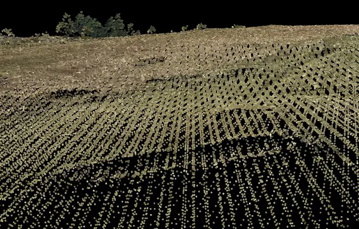
Aerial laser scanning uses a dense patchwork of individual laser points to measure the ground. The data from these can be used as the basis for incredibly detailed images, showing features not visible to the naked eye. Can you see the low earthworks of a building in this image? It measures about 10m in overall length. You can also see some trees in the background.

Uncovering the past
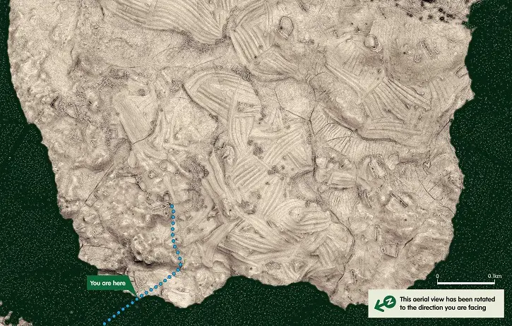
This aerial plan, created using ALS data, shows the topography of the site and gives us a glimpse into how the land was used by those who lived there. The low earthworks and the tumbled walls of the buildings and enclosures are all visible – and some of the most obvious features are the areas of rig and furrow where crops were grown.

A bird's eye view of Rosal
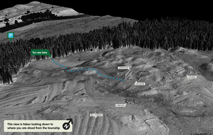
Exploring the 3D surface model allows an even clearer view of how the village was laid out. The low earthworks and tumbled walls of longhouses, enclosures and rig-and-furrow cultivation can all be seen within this 3D image. This image (and the plan above) were both used as part of the visitor orientation panels.

Visit the township
If you're ever in the far north of Scotland, why not visit Rosal? As well as having the opportunity to explore the township, you'll be able to hear recordings of a first hand account of the evictions as well as view larger versions of the images show above.