


Thursday, 05 Mar 2026
It’s Scottish Apprenticeship Week! Apprentices are an important part of our workforce - helping us …
The forest track to Plodda Falls has suffered some damage and has quite a number of potholes. Please drive carefully. We are hoping to repair as soon as we can.
A hidden treasure, with a spectacular waterfall cascading past towering trees.
Lord Tweedmouth bought this area from Laird Fraser in 1856. Tweedmouth was a rich brewer and Liberal Member of Parliament. Most of the magnificent Douglas fir, larch, grand fir and redwoods you’ll see were planted by him. He also built Guisachan House. The house is long gone, but the legacy of his fine trees lives on.
Visit an amazing vertical cascade dropping beneath the Douglas firs into the Abhainn Deabhag with an almighty roar.
Mostly firm gravel surface, with uneven section that may be narrow, grassy or muddy. Steep slopes with some stone steps. Includes some exposed tree roots.

Allow ½ hour
This short trail will take you to a heart-stopping view right over the top of the Falls. It is said that Lord Tweedmouth had the course of the river changed to make the falls even more impressive.
Wander through the majestic Douglas firs and larch, planted by Lord Tweedmouth on the former Guisachan estate.
Uneven gravel and earth paths with narrow and rocky sections. Several steep slopes and sets of stone steps. Includes some potentially muddy sections and exposed tree roots.
Allow 1 hour
This circuit follows the river back to the bottom of the falls, so you can hear the thunder of the water as it hits the rocks, as well as experience the giddy heights of the view from the top.
The Coach House Café in Tomich serves snacks, and there are places to eat and a shop in Cannich. There are no cafés or shops in Glen Affric itself.
There is little mobile phone reception in the glen, so you may not be able to use electronic devices that rely on a network connection.
There is no charge to park in this car park.
Much of the road through the glen is single track. Drive slowly and pull over to let other cars pass at the passing places.
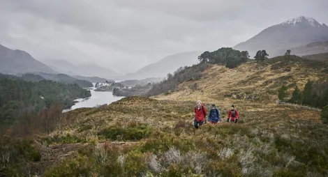
Getting to Plodda is quite an adventure. The forest is 5 miles (8 km) beyond the tiny village of Tomich, along narrow road and forest track. Drive slowly and pull over to let other cars pass at the passing places.
From Inverness or Fort William, follow the A82 along Loch Ness to Drumnadrochit. Turn onto the A831, signposted for Canaich (Cannich). After about 10 miles (16 km), at a sharp right-hand bend before you reach Cannich village, turn left onto a minor road signposted for Tomich. Follow this road for about 6¼ miles (10 km), going through Tomich village. It's a narrow road - and after Tommich just a forest track – but keep going and you’ll reach the car park at grid reference NH 279 238.
IV4 7LY is a postcode on the road leading to Plodda. Keep going for another 1¾ mile (2.8 km) to reach the car park.
Buses run from Inverness to Tomich and Cannich throughout the year. For details visit Traveline Scotland.
Have a question or suggestion for improvement?
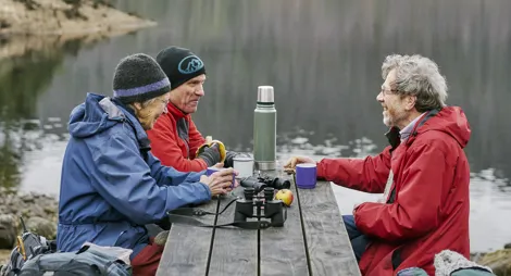
A lochside picnic spot with gentle woodland paths
Picnic by rushing rapids, with glorious woodland walks

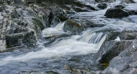
A rushing river, the gateway to Glen Affric
Thursday, 05 Mar 2026
It’s Scottish Apprenticeship Week! Apprentices are an important part of our workforce - helping us …

Wednesday, 25 Feb 2026
Guest blog by Beat Forester Sam Brown. There has been a lot going on in the glen over the past two y…

Wednesday, 21 Jan 2026
Red Squirrel Appreciation Day falls on the 21 January this year and we're sharing some of our favour…