
Thursday, 05 Mar 2026
It’s Scottish Apprenticeship Week! Apprentices are an important part of our workforce - helping us …
This secluded car park is set among Scots pine and birch trees, with a lovely view of the loch. It’s a great place for a picnic or a stop to enjoy the peace and quiet. There are no waymarked trails, but small paths lead through the trees along the loch side. A few hundred yards back down the glen, the steep track by Allt na Imrich (the burn of the flitting) has stunning views.
The loch is as much a part of the National Nature Reserve as the forests, but it’s not quite as natural as it looks. It’s part of an ambitious hydro-electric project, developed in the 1950s. Water is piped from Glen Cannich to the north, into the loch. From there it flows to the power station at Fasnakyle, down the glen towards Cannich.
This elaborate system was developed to protect Glen Affric’s landscape and wildlife. It meant Loch Beinn a’ Mheadhain didn’t need to be expanded. The dam at the end of the loch is so small you’re hardly aware of it. But the loch’s level does change, depending on how much water the power station needs. We provide floating platforms for birds to create nests on that adjust with the changing water levels. This helps species such as black-throated divers, which call the loch home.
The nearest toilets are at Dog Falls. You’ll find places to eat in Cannich or Tomich and a shop in Cannich. There are no cafés or shops in Glen Affric itself.
There is little mobile phone reception in the glen, so you may not be able to use electronic devices that rely on a network connection.
There is no charge to park in this car park.
Much of the road through the glen is single track. Drive slowly and pull over to let other cars pass at the passing places.
From Inverness or Fort William, follow the A82 along Loch Ness to Drumnadrochit. Turn onto the A831, signposted for Canaich (Cannich). In Cannich village, turn left onto the minor road signposted for Glen Affric. Loch Beinn a’ Mheadhain is about 8 miles (12.8 km) along this road.
Please note, the car park is not suitable for coaches.
IV4 7LN is the postcode for the centre of Cannich village. Follow directions above from there.
Buses run from Inverness to Tomich and Cannich throughout the year. For details visit Traveline Scotland.
Have a question or suggestion for improvement?
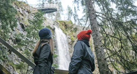
One of Scotland’s most spectacular waterfalls
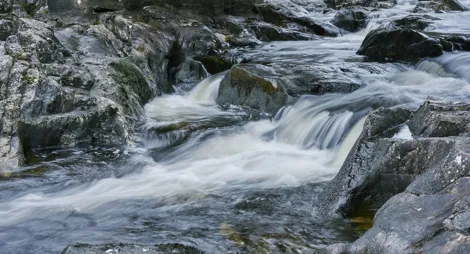
Picnic by rushing rapids, with glorious woodland walks

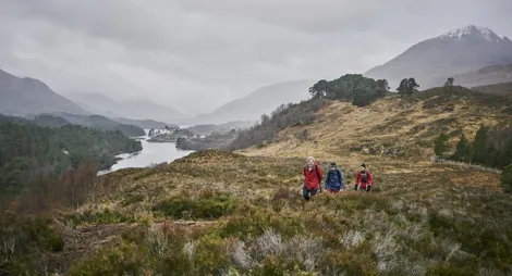
A rushing river, the gateway to Glen Affric
Thursday, 05 Mar 2026
It’s Scottish Apprenticeship Week! Apprentices are an important part of our workforce - helping us …

Wednesday, 25 Feb 2026
Guest blog by Beat Forester Sam Brown. There has been a lot going on in the glen over the past two y…

Wednesday, 21 Jan 2026
Red Squirrel Appreciation Day falls on the 21 January this year and we're sharing some of our favour…