


Thursday, 05 Mar 2026
It’s Scottish Apprenticeship Week! Apprentices are an important part of our workforce - helping us …
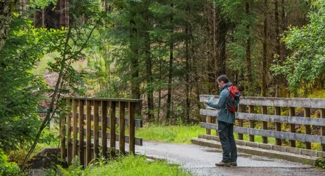
A waymarked trail will give you a viewpoint to the wild northern slopes of Carn Mor Dearg and Ben Nevis. Look up to the towering cliffs and see if you can see any climbers scaling the North face of Ben Nevis.
Listen for the soothing sound of the Allt a Mhuilinn, meaning ‘the mill stream’, as you head uphill. The stream once powered an old mill. It now supplies hydro-electric power to the aluminium smelter in Fort William.
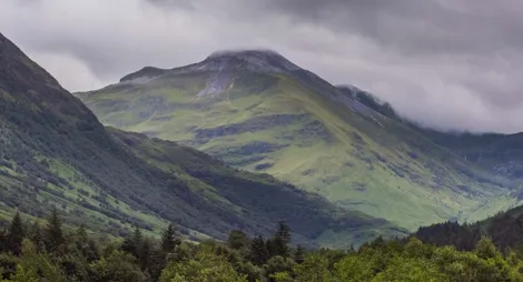
A steep climb is rewarded with magnificent views into the towering North face of Ben Nevis, over Fort William and out west towards the road to the Isles.
A good smooth surface, with long steep slopes throughout. The upper path is narrow and can be slippery when damp.

Allow 1 ½ hours
Following the Allt a Mhuillin (the mill stream), this steep path has fine views of Ben Nevis and Loch Eil. Britain’s highest mountain is particularly impressive from this trail, as the menacing 2000 ft (610 m) cliffs of the North Face tower above you. You may well see climbers tackling the challenging routes across the rock face.
Beyond the stile the path enters open hillside: you’ll need the right clothing and equipment for this.
North Face car park is the starting point for the Carn Mor Dearg Arete route up Ben Nevis. It's a long and extremely challenging route even for experienced hill walkers. It should only be attempted with proper planning and equipment. When conditions are good it is one of the most spectacular hill walks in Scotland.
This is not to be confused with the more straightforward Mountain Path route up Ben Nevis, accessible from Glen Nevis. Weather conditions can change quickly in the hills and this route is still long and exposed.

The nearest public toilets are in Fort William, 3 miles to the south, or Nevis Range, 2 miles to the north.
The charges to park at North Face are:
Blue Badge holders park free. Please display your Blue Badge clearly.
Payment can be made using card or RingGo.
Annual parking passes are available for this site, visit our parking page for more information.
From the A82 at Torlundy, follow the turn-off signposted for the 'North Face' car park. Follow this road up over the railway line where another sign on the right will guide you to the car park.
PH33 6SW is the nearest postcode to the turn-off at Torlundy.
Buses between Fort William and Nevis Range/Spean Bridge can stop at Torlundy on request. Plan your journey at Traveline Scotland.
Have a question or suggestion for improvement?
A nationally renowned hub of outdoor activities
Gateway to one of Scotland's iconic glens
A perfect picnic spot on your long drive to the West Highlands
Thursday, 05 Mar 2026
It’s Scottish Apprenticeship Week! Apprentices are an important part of our workforce - helping us …

Wednesday, 25 Feb 2026
Guest blog by Beat Forester Sam Brown. There has been a lot going on in the glen over the past two y…

Wednesday, 21 Jan 2026
Red Squirrel Appreciation Day falls on the 21 January this year and we're sharing some of our favour…