Wednesday, 25 Feb 2026
Guest blog by Beat Forester Sam Brown. There has been a lot going on in the glen over the past two y…
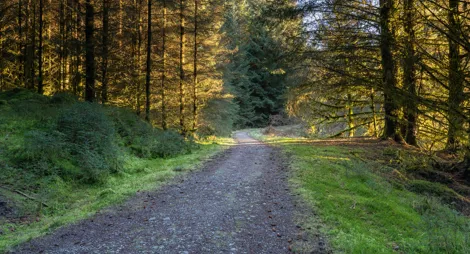
This small car park provides access to the southern end of Loch Ard Forest. The tracks here are great for cycling, horse riding and walking.
Head deep into the forest for good views over the Carse of Stirling and the Highland Boundary Fault. Experience a section of the Rob Roy Way and catch a glimpse of Ben Lomond on route. Great for walking, cycling or horse riding.
Firm tarmac and gravel surface throughout. Long moderate slopes for up to 500m. One road crossing.

Allow 3 hours
This route heads into Loch Ard Forest, crossing the line of one of the two tunnels that has been carrying Glasgow's water supply from Loch Katrine to Milngavie since Victorian times.
This quiet woodland is ideal for horse riding and cycling. National Cycle Route 7 links Drymen and Aberfoyle via Old Drymen Road.
The 94 mile Rob Roy Way begins in Drymen and turns off here into Loch Ard Forest on its way to Aberfoyle and ultimately Pitlochry. The route follows the tracks and paths used by Rob Roy MacGregor, Scotland's most notorious outlaw.
The nearest public toilets are in Drymen.
There is no charge to park in this car park.
Old Drymen Road car park is on the east side of the minor road that links Drymen and Gartmore. From the centre of Drymen, turn onto Old Gartmore Road (The Clachan Inn will be on your left) and head north for 4 miles. From Gartmore village (which is well signposted from the A81 south of Aberfoyle) follow signs to Drymen for 2 ½ miles.
G63 0EA is the nearest postcode.
Have a question or suggestion for improvement?

Remote woodland in the hills above Drymen

Relax in this tranquil forest setting. Enjoy a relaxing walk in the Oak woodland or a lazy picnic by the River Forth.

A picturesque loch ideal for family strolls and cycle rides