Wednesday, 21 Jan 2026
Red Squirrel Appreciation Day falls on the 21 January this year and we're sharing some of our favour…
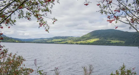
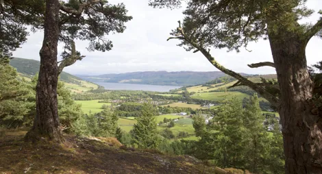
Discover the secret side of Loch Ness at this much-loved spot with views across Loch Ness and towards the ancient fort of Dun Dearduil. The rocky trails wind through tall conifers to reach a secluded lochan, Lochan Tòrr an Tuill, known locally as the ‘Magic Loch’. This peaceful spot is a lovely place to soak in the atmosphere and enjoy a picnic.
For a longer walk, try the Farigaig Circular - continue on past the lochan following the Trail of the 7 Lochs, cut across to the South Loch Ness Trail when you reach the main road and return via the forest road. If you’re short of time, you don’t have to go far to enjoy the scenery – the viewpoint at the start of the trail is a great place to take in the view.
Climb steeply on the rocky shoulder of Spital of Boleskine for magnificent views of the ancient fort on Dun Dearduil, before continuing on to the hidden Lochan Tòrr an Tuill.
Section of rough and narrow earth path with muddy and rocky parts. Long steep slopes for up to half a mile.

Allow 1 hour
Farigaig is a highlight along the South Loch Ness Trail, a 28 mile (45km) route linking Loch Tarff near Fort Augustus with Torbreck on the edge of Inverness. Most of the trail is easily accessible for walking, cycling and horse-riding and roughly follows the line of the historic General Wade’s Military Road along the loch shore.
There is a network of paths from the Farigaig car park as well as our waymarked trail, including a link over the hill to nearby Foyers. The Highland Council’s Paths around Foyers leaflet gives you more information.
For a longer walk, try the Farigaig Circular - continue on past the lochan following the Trail of the 7 Lochs, cut across to the South Loch Ness Trail when you reach the main road and return via the forest road. If you’re short of time, you don’t have to go far to enjoy the scenery – the viewpoint at the start of the trail is a great place to take in the view.
The car park is provided by the local community group. There is a toilet available in the car park, also provided by the community group.
There is no charge to park in this car park. Please park with care and consideration. In particular please park in designated parking areas only and do not block entrances or gates.
Farigaig Forest is on the south side of Loch Ness, beside the B852 near Inverfarigaig.
From Inverness, take the B862 to Dores and then the B852 to Inverfarigaig. From Fort Augustus, take the B862 to Whitebridge and then the B852 via Foyers to reach Inverfarigaig.
At Inverfarigaig, look for the turning to Errogie, also marked with Forestry Commission signs to Farigaig. The car park is about 100 yards (100 metres) up this road on the right hand side.
Nearest postcode: IV2 6XR
There is an infrequent bus service between Inverness and Fort Augustus that stops at Inverfarigaig. You’ll find details at Traveline Scotland.
Have a question or suggestion for improvement?

A gentle, atmospheric stroll through oakwoods to a magnificent waterfall

Peaceful picnic spot on Loch Ness' south shore with views over Urquhart Castle

Spectacular views over Urquhart Bay from the crag named after a Viking Prince